On this page:
Conservation in action
We are acting now to protect threatened species and ecosystems and secure their future. We're doing this by establishing more than 20,000 hectares of reserves and protected areas around Melbourne.
We also run much-needed management programs for some of our most vulnerable species, like the southern brown bandicoot and growling grass frog.
Our key conservation outcomes:
- establishing the 15,000 hectare Western Grassland Reserve
- creating 1,200 hectare grassy eucalypt woodland protected area
- securing 36 new conservation areas across more than 5,000 hectares in Melbourne’s newest suburbs.
- securing more than 140km of growling grass frog habitat and creating more than 80 wetlands
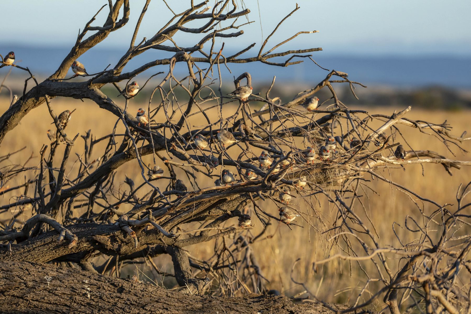
- protecting and looking after the southern brown bandicoot
- protecting and managing habitat for the golden sun moth, matted flax-lily and spiny rice-flower.
We regularly monitor our programs and reserves using the latest scientific research and techniques.
We also work with our partners, including Traditional Owners, government agencies, local councils and other organisations to achieve our conservation goals.
MSA program conservation areas, reserves and management areas
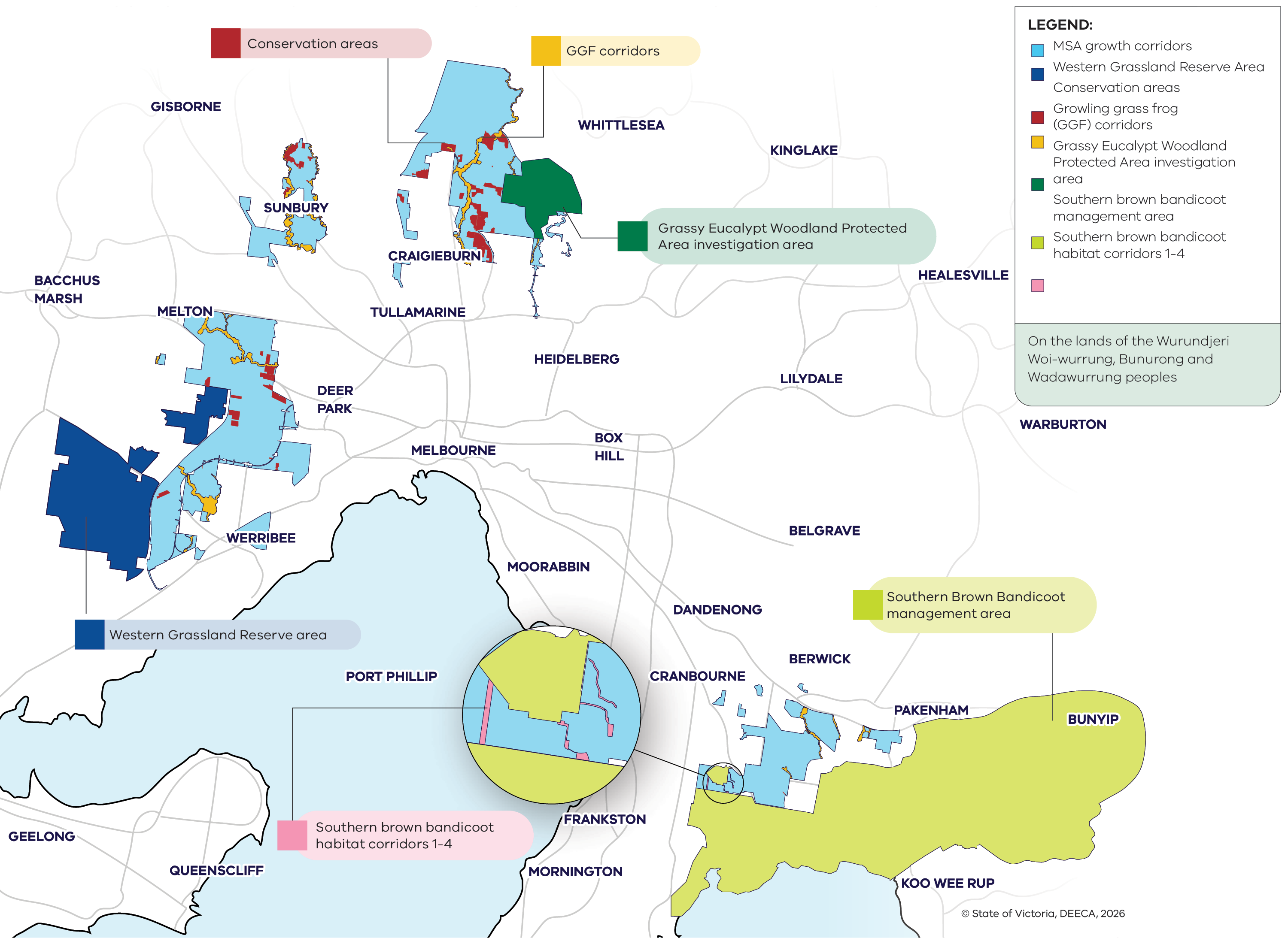
On the map, each numbered area is represented by a distinct colour that matches its conservation purpose.
1. Western Grassland Reserve Area
- Establishing the 15,000-hectare Western Grassland Reserve, shown in dark blue on the map.
- A large protected reserve in Melbourne’s west that conserves native grasslands and threatened species as the city grows.
2. Conservation areas
- Securing 5,000 hectares across 36 conservation areas in Melbourne’s newest suburbs, shown in red on the map.
- Smaller, distributed areas within growth corridors that protect important local biodiversity values.
3. Growling grass frog corridors
- Protecting 140 kilometres of creeks and corridors and creating 80 wetlands for growling grass frogs, shown in yellow on the map.
- Creek and wetland‑based corridors that connect habitats and support the movement and survival of the growling grass frog.
4. Grassy Eucalypt Woodland Protected Area investigation area
- Establishing the 1,200-hectare Grassy Eucalypt Woodland Protected Area, shown in dark green on the map.
- An area near Whittlesea being assessed for permanent protection of Grassy Eucalypt Woodland habitat.
5. Southern brown bandicoot management area
- Protecting the southern brown bandicoot by establishing habitat and connectivity between populations, shown in light green on the map.
- Areas in Melbourne’s south‑east that protect southern brown bandicoot habitat and improve connectivity between populations.
How is the program funded?
Our program is funded by MSA levy. This means developers are legally required to pay levies to offset the impact of development on the environment.
We use these funds are used to establish conservation areas and deliver conservation outcomes - so the program proceeds at the same rate as development, which is expected to finish around 2060.
Key documents
For a copy of Delivering Melbourne's Newest Sustainable Communities Strategic Impact Assessment Report, October 2009, please email conservation.msa@deeca.vic.gov.au.
Page last updated: 16/07/26